Long before GPS apps and satellite maps, African civilizations were moving across deserts, rivers, forests, and oceans with surprising accuracy. They didn’t have compasses or digital tools. What they had instead was deep knowledge of the natural world, passed down through generations.
They learned to read the land, the stars, the wind, and even animal patterns. These weren’t just random tricks, they were part of a rich system of knowledge, often rooted in culture, spirituality, and survival. Let’s explore seven powerful ways ancient Black civilizations found their way without modern tools:
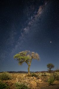
1. Stars
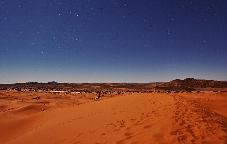
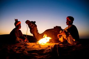
In the wide-open Sahara Desert, where there were no signs or roads, travelers used the stars to find direction. Berber and Tuareg traders, who journeyed between North Africa and West African empires like Ghana and Mali as early as the 8th century, relied on the North Star (Polaris) to guide them northward.
They also used star patterns like Orion’s Belt or the Southern Cross, which helped show east, west, and seasonal changes. This star knowledge wasn’t random, it was taught through stories and training passed down over generations.
In Mali, the Dogon people were especially known for their deep astronomy. Long before telescopes, they accurately described Sirius B (a small star that can’t be seen with the naked eye) as part of their spiritual beliefs and sky traditions.
2. Winds
On the Swahili Coast of East Africa, traders didn’t just sail blindly. They understood the wind. By the 11th century, Swahili merchants were using the monsoon wind system to sail to and from Arabia, India, and Persia.
The northeast wind, called Kaskazi, would blow from December to March, helping ships sail southward. Then, from June to September, the southeast wind, Kusi, would blow the other way. These wind patterns were like a schedule and East African sailors planned their trading trips around them every year.
This predictable wind knowledge helped coastal cities like Kilwa, Mombasa, and Zanzibar become wealthy global trading ports.
3. Memory
Maps weren’t always needed when knowledge was stored in people’s minds. In many parts of Africa, directions were passed on through spoken word. Elders taught children how to get around by remembering what to look for: a leaning baobab tree, a bend in the river, a special kind of rock.
In West and Central Africa, people used songs, chants, or proverbs to remember long paths through forests or between villages. These were sometimes called “songlines”. They were like a living map stored in stories.
This memory-based navigation wasn’t just clever but effective. People could travel hundreds of kilometers relying only on what they remembered and heard from others.
4. Nature

People who lived close to the land noticed details many of us now overlook. In the desert, travelers studied sand patterns to see which way the wind had been blowing. It helped them stay on track. In forests, the sound of birds or insects could tell if water or open land was nearby.
Some knew how to follow ant trails that led to water. Others used changes in plant types or tree growth to tell direction. Even the way the sun heated different parts of the land during the day helped them figure out time and space.
5. Rivers and Sun
The Nile River was more than a source of water, it was a natural guide. Since the Nile flows from south to north, travelers along its banks always knew which way they were heading.
Ancient Egyptians and Nubians also used the sun to figure out direction. They used simple tools like shadow sticks (gnomons) to tell where the sun was in the sky. Their buildings, especially temples and pyramids, were often aligned with the sunrise or the stars.
These alignments weren’t just for beauty or religion but helped with orientation and timekeeping.
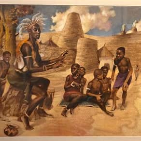
6. Local Guides
When rulers like Mansa Musa of Mali traveled long distances (his famous pilgrimage to Mecca in 1324 included thousands of people) they relied on trusted guides to lead the way.
These guides weren’t reading from maps. They had learned the land by walking it. They knew which villages were friendly, which areas had water, and which paths to avoid. Their skill came from experience and community memory.
Across Africa, these kinds of guides were highly respected. They were like human GPS; reliable, trained, and often spiritually in tune with the land.
7. Buildings and Science
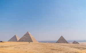
Some ancient African societies used math and astronomy in the way they designed their cities. The pyramids of Egypt are one example: their sides are closely aligned with the four cardinal directions.
The Nubians (in what is now Sudan) also built temples and pyramids that lined up with the sun and stars. In West Africa, the ancient city of Timbuktu was home to scholars who studied astronomy, geography, and mathematics.
These structures and studies show that Africans weren’t just surviving, they were thinking, designing, and using scientific knowledge to understand the world around them.
In Summary…
Long before modern maps and navigation apps, ancient Black civilizations were moving across huge regions with skill and confidence. They used the stars, the wind, memory, nature, rivers, local guides, and science to find their way.
This knowledge wasn’t random but was shared, practiced, and respected. It came from paying close attention to the world. And it worked.
Even today, there’s something powerful about remembering that the Earth itself is a kind of map and our ancestors knew how to read it.
What surprised you the most about how ancient African civilizations navigated the world without maps?
Drop your thoughts in the comments, we’d love to know what stood out to you or what you learned for the first time.